Nvidia Confirms Major OpenAI Investment Amid AI Funding Race
  Sony Q3 Profit Jumps on Gaming and Image Sensors, Full-Year Outlook Raised
  Britain has almost 1 million young people not in work or education – here’s what evidence shows can change that
  Canada’s local food system faces major roadblocks without urgent policy changes
  SpaceX Prioritizes Moon Mission Before Mars as Starship Development Accelerates
  AI is driving down the price of knowledge – universities have to rethink what they offer
  Tencent Shares Slide After WeChat Restricts YuanBao AI Promotional Links
  Elon Musk’s Empire: SpaceX, Tesla, and xAI Merger Talks Spark Investor Debate
  Baidu Approves $5 Billion Share Buyback and Plans First-Ever Dividend in 2026
  Why have so few atrocities ever been recognised as genocide?
  Glastonbury is as popular than ever, but complaints about the lineup reveal its generational challenge
  Debate over H-1B visas shines spotlight on US tech worker shortages
  SpaceX Reports $8 Billion Profit as IPO Plans and Starlink Growth Fuel Valuation Buzz


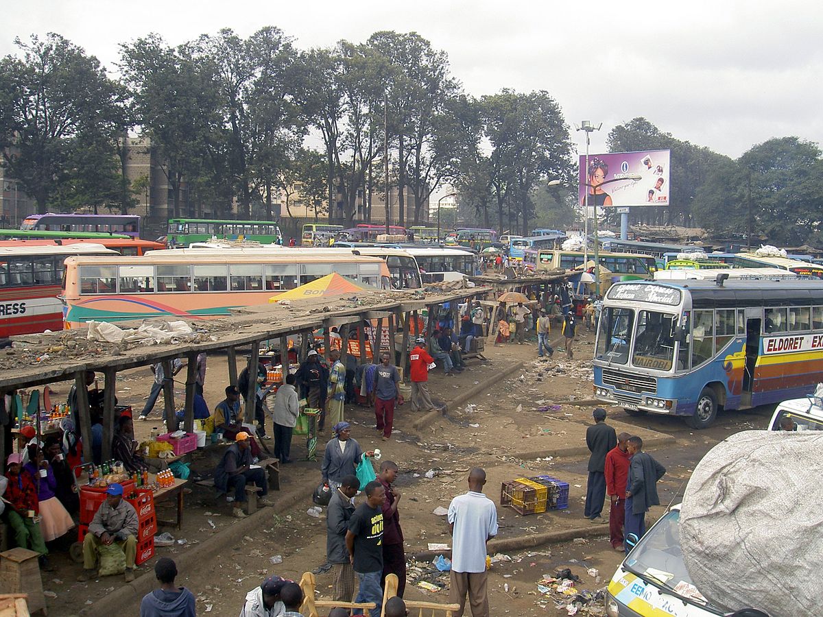

A collaboration between Kenyan and American universities has produced the first comprehensive public transport data for a micro minibus (matatu) system in Africa. Digital Matatus continues to collect and update data on matatu routes in Nairobi and is supporting projects elsewhere. The aim is to use technology and local partnerships to help planning as well as commuters use semi-informal transit networks more efficiently. Jacqueline M. Klopp, who put together the team, shares her insights
*How is your project empowering communities and planners in Nairobi? *
Good information about transport is critical for citizens in any place. It is unacceptable that this is ignored in many places in Africa. If people can’t even see their routes as routes and their system as a system, it gets harder to engage in conversations about improvements.
Involving the public in data collection - through crowd sourcing - to produce critical public services such as maps and transit apps helps build new conversations on how the system can be improved.
Transportation planning in so many cities is top down, a kind of tyranny of experts. This was well illustrated on one of the highway projects in Kenya where the bus stops that everyone uses were not catered for with terrible consequences. Mapping when done collaboratively, openly and with citizens can be a useful tool in improving transportation planning.
What is the biggest opportunity for crowd sourcing data in African cities?
The rapid expansion of cellphone use offers one of the biggest opportunities to collect critical data. In Nairobi, almost every adult has a phone, and increasingly these are smart phones. This means everybody can help generate data about the city including about its transportation system. They can do this in two main ways.
First, “digital exhaust” of the phone or the geo-location data that gets transmitted through calls can be helpful. This becomes part of big data that can be analysed to see how the city moves. In Abidjan, Orange released this data and IBM research used it to help optimise bus routes. But telecommunications companies often don’t like to make this data open, even when anonymised.
The second way to generate data is for citizens to actively share information. This can be through various forms of social media as in the popular Nairobi transport app ma3route. In Mexico City Mapaton is collecting data on public transit from inputs in apps even by playing games.
The potential is enormous. One powerful example is the Nairobi accident map that uses five months of crowdsourced data on crashes. This is validated using police records and shows visually where there are clear safety problems that require interventions such as street redesign.
How can more cities get involved in the digital matatus project?
Since Digital Matatus successfully mapped out the Nairobi minibus (or matatu) system, more groups in cities are replicating this process. These cities include Kampala, Maputo, Accra, Lusaka, Amman, Cairo, Managua and elsewhere.
Digital Matatus has been providing informal support for a number of these cities. But we would like to scale this effort up, build better tools and provide a resource centre and network where groups in different cities can share and help each other.
How is crowdsourcing data different in particular cities? Are there regional variations, or variations based on the democratic nature of governments?
All places are unique and create challenges. For example, in Nairobi routes are numbered but in many cities this is not the case. And the complexity and size of transport systems differ. Cape Town and Nairobi are about the same size as cities with around 3.5 million people. But Cape Town has over 600 routes while Nairobi has 138.
Teams in Accra and Maputo involve the city governments in mapping minibuses called trotros. In other cities, there is a standoffish approach by local government to transit mapping by citizens. So a lot of variation exists based on the political interests and institutions involved in the transit system, how the system is regulated and the strategy around mapping.
What are the challenges of mapping informal transit networks that may not even see themselves as networks?
There are a lot of technical challenges. These include, stops that are sometimes not marked or named. And routes may not have names or numbers and can vary. It takes many trips to understand some routes or to distinguish multiple routes which look like one.
Also fares are often not set and fluctuate based on unclear factors, such as a rainstorm.
In addition, the data format that is most commonly used for transit was developed for formal systems so it can be hard to clean and fit the data into this format. However, we have found ways to do this by minor modifications.
*What are the lessons learned from your project in Nairobi? *
Creating quality transport data for cities like Nairobi that have high levels of informality is challenging. But it is possible.
We also learned that there is demand for this information from citizens and planners. We now know that the data collection and editing tools need improvement. Another lesson is that making the mapping process inclusive and collaborative is critical to provoking new planning conversations.
Once we had proof of concept and our data was being used by a wide variety of people and organisations, including the World Bank, we thought they would understand the need to create more data and really support these efforts. Instead, we learned that getting financial and institutional support for these initiatives involves a serious struggle.
Mainstreaming new forms of data collection into the transportation sector will take a lot more work if we’re going to monitor the sustainable development goal targets on transport, access and safety.
What needs to be done to make sure that data is updated?
Transit systems are dynamic, and it is critical that data is constantly updated. In the near future, we will be moving to real time data across the globe so buses, for example, will give a continuous feed. Mexico City just mandated this. Kigali is starting such a system. Eco-Mobility and University of California Berkeley are experimenting with technology in Nairobi supported by bus owners who wish to see where their vehicles are at any moment.
But this will take some time. And, regardless, we still want to leverage cellphone technology to create basic data on the structure of transport systems in cities like Nairobi. Digital Matatus is also moving forward with a new editing tool and also experimenting with crowdsourcing. We are exploring a new app developed by MIT students called ma3tycoon. Our team also continue efforts to get government, multilaterals and transportation planners to understand the importance of this base data for planning- and ultimately for improving conditions for passengers.
_This is an edited version of an interview first published by ITDP _
 Jacqueline M Klopp receives funding from Volvo Research and Education Foundations for research into transport in Nairobi and received funding from the Rockefeller Foundation for the Digital Matatus work. She is part of DigitalMatatus.com and the Center for Sustainable Urban Development at Columbia University.
This article was originally published on The Conversation. Read the original article.